Època IV
VOLUM XXI
NÚMERO 53
juny 2016
ISSN: 1988-2459
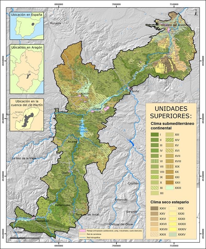
Mapa de paisajes físico-geográficos del Parque Cultural del río Martín (Teruel, Aragón) escala 1:50.000
Los mapas de paisajes realizados desde el enfoque geográfico cuentan con una cualidad inherente a esta disciplina, cual es la consideración integral –y a la vez necesariamente sintética– de sus...
Franch-Pardo, I. (Escuela Nacional de Estudios Superiores unidad Morelia (ENES-Morelia, UNAM) i Área de Geografía Física (Universidad de Jaén)); Espinoza-Maya, A. (Centro de Investigaciones en Geografía Ambiental (CIGA, UNAM)); Cancer-Pomar, L. (Área de Geografía Física (Universidad de Jaén)); Bollo-Manent, M. (Centro de Investigaciones en Geografía Ambiental (CIGA, UNAM))
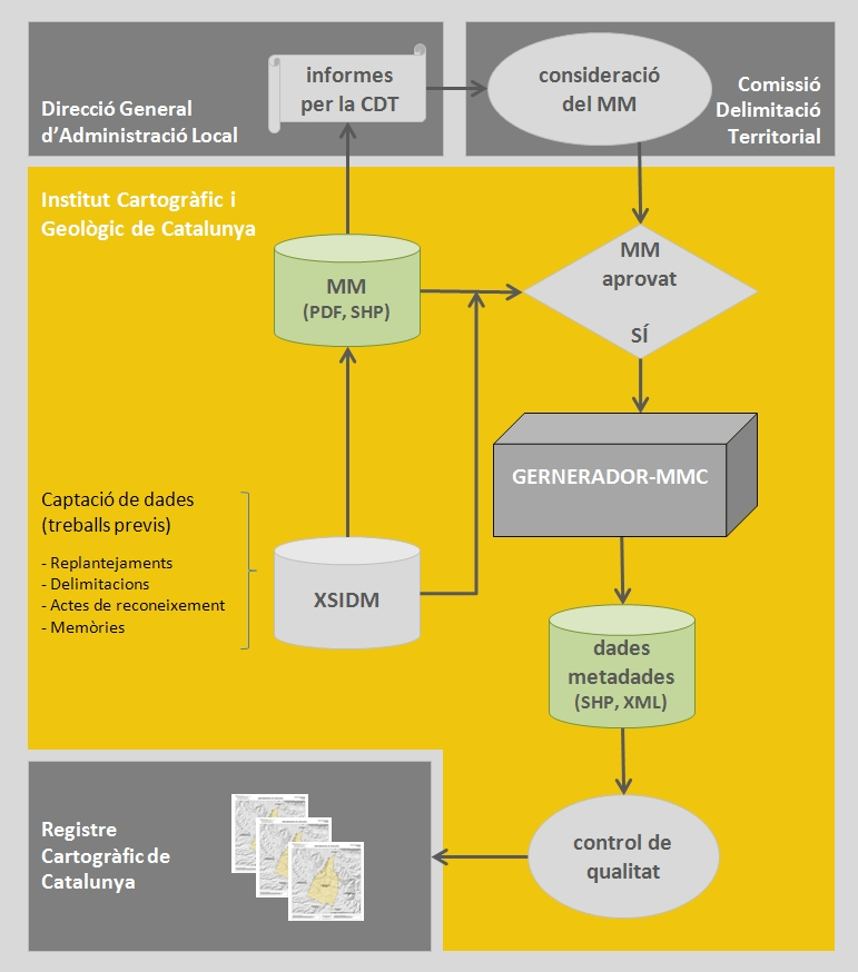
Aplicació Python(R) per automatitzar el procés d'inscripció d'un Mapa municipal al Registre Cartogràfic de Catalunya
La Generalitat de Catalunya, mitjançant el Departament de Governació, Administracions Públiques i Habitatge (DGAPH) i l’Institut Cartogràfic i Geològic de Catalunya (ICGC), està impulsant ...
Masdeu, F. - Institut Cartogràfic i Geològic de Catalunya

Georeferenciación de cartografía antigua con la ayuda de la comunidad: la experiencia de la Cartoteca de Cataluña (ICGC)
Una vez creadas con éxito las cartotecas digitales el nuevo reto está siendo la georeferenciación de los fondos mediante la adopción de Sistemas de Información Geográfica (SIG). Se trata de la u...
Ramos, N. - Institut Cartogràfic i Geològic de Catalunya
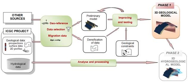
3D Geological modelling for groundwater management in Cardona
Throughout the long history of the mining development of the Cardona’s diapir, there have been several episodes of groundwater inflow due to the interception of karst conduits. Over the years, the k...
Colomer, M., Herms, I., Arnó, G., Camps, V. - Institut Cartogràfic i Geològic de Catalunya
Photogrammetric processing using ZY-3 satellite imagery
INPUT DATA
ZY-3 Sensor Description
On January 9, 2012 China launched a new remote sensing satellite, carrying three high-resolution panchromatic cameras and an infrared multi-spectral scanner (I...
Kornus, W., Magariños, A., Pla, M., Soler, E., Pérez, F. - Institut Cartogràfic i Geològic de Catalunya
