Època IV
VOLUM XII
NÚMERO 31
juliol 2007
ISSN: 1988-2459
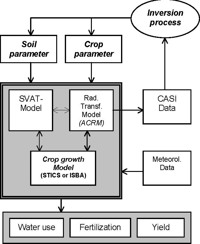
Assimilation of hyperspectral data into crop growth models: Precision farming application for maize in Catalonia
The agriculture in Catalonia (Spain) suffers from the excessive use of fertilization and the waste of irrigation water. Over-application of pig manure and flood irrigations can cause severe environmen...
Kurz, F. (Institute of Remote Sensing Technology, DLR-German Aerospace Center); Martínez, L., Palà, V., Arbiol, R. (Institut Cartogràfic de Catalunya); Villar, P., Calvet, F. (LAF - Laboratori d'Anàlisi i Fertilitat dels Sòls Sidamon)
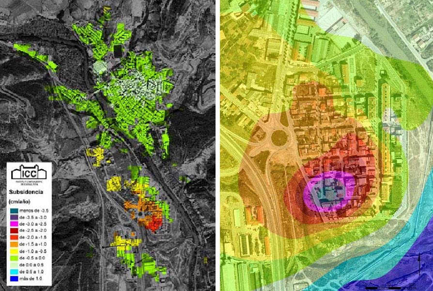
Medidas de deformación del terreno a vista de satélite
Uno de los grandes problemas de la monitorización de los movimientos de un área de terreno determinada es el gran esfuerzo económico y humano necesario para establecer y medir regularmente una seri...
Mora, O., Palà, V., Arbiol, R., Adell, A., Torre, M. - Institut Cartogràfic de Catalunya

Advanced Classification Techniques: A Review
For years, many efforts have been made to develop automated procedures for land use map production using remote sensing image data. However, the situation is still characterised by a considerable oper...
Arbiol, R. (Institut Cartogràfic de Catalunya); Zhang, Y. (University of New Brunswick, Department of Geodesy and Geomatics Engineering); Palà, V. (Institut Cartogràfic de Catalunya)
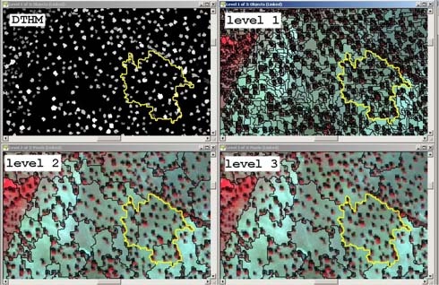
Combined use of lidar and quickbird data for the generation of land use maps
Usually, land use cartographic studies performed by means of satellite image data require multispectral imagery from different seasons or dates and process methodology use to be pixel oriented. Nowada...
Viñas, O., Ruiz, A., Xandri, R., Palà, V., Arbiol, R. - Institut Cartogràfic de Catalunya
