Naples urban territory lies on the eastern flank of the active Phlegrean Fields volcanic district. Its geological structure results from the interplay of several processes: volcanism, tectonics and volcanotectonics, sedimentary, while its coastal and nearshore location favour the influence of the eustatic variations of the sea level. Since its foundation (X-VII century b.C.) Naples has been affected by natural hazards, such as floods and earthquakes. Furthermore, its location on the biggest explosive active volcanic field of the Mediterranean area exposes this megacity to a very high volcanic risk.
The present geological studies, finalized to the realization of the geological map of Naples area (CAR.G. Project) financed by the Regional Government of Campania Region and by the National Environmental Agency, are devoted to the collection and interpretation of geological data useful to the management of a high-risk territory, and to protecting, preserving and improving the environment. This new geological map improves the previous geological map of the area (Rosi & Sbrana 1987).
DATA SET
A multidisciplinary approach was used to improve the knowledge on this area through:
- Surface geological survey. A new geological mapping survey is carrying out with data collection at the 1:5000 scale. All field data are processed by using GIS technique.
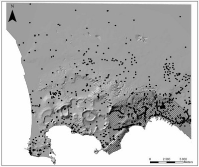
- Subsurface geological data. The framework of the subsurface geology was reconstructed through the implementation of a data-base of shallow wells (drilled for water research, geotechnical purposes and stratigraphy) and deep boreholes (drilled for geothermal research). The interpretation of the existing borehole data (Fig. 1) allowed to carry out geological sections and to plan the drilling of new wells (continuous coring technique) for calibrating the existing subsoil data base. The final aim of this section of the project is a 3D reconstruction of Naples subsurface geology.
- High-resolution seismic survey in coastal areas and offshore. This topic will provide the integration of inland data with offshore data (high-resolution seismic, bathimetry, side scan sonar data and subaqueous geological survey). This aspect appears relevant for the improvement of the geological knowledge because the half southern part of the Phlegrean Fields volcano is submerged. In particular it will be usefull for the correct interpretation of the volcano geology and of its eruptive structures, calderas, craters, and of related hazard aspects. In this framework 16 new high-resolution seismic lines, integrating a wide data-base of seimic lines existing on Naples and Pozzuoli gulf (Mirabile L. et al., 2000), were performed in Posillipo, Chiaia and Naples harbour coastal areas using a multitip sparker technology.
- Collection of analytical data (Ar/Ar dating, tephrostratigraphy, biostratigraphy, petrography, geochemistry) necessary to the new geological survey is in progress.

Figure 1 – Location of wells, from project data-base.
RESULTS
The reconstruction of the geological and structural framework of the hills of the urban area is one of the main results concerning Naples geology. The rare outcrops and the study of hundred of wells (Fig.1) allowed highlighting that Naples hills represent the eastern uncollapsed remnants of the old volcanic field, made by several coalescent tuff cones and lava domes, older than the Campanian Ignimbrite (CI) eruption (39 ky b.p.). The tuff cone deposits are covered by pre-CI pyroclastic units and by CI proximal deposits. In the typical outcrop of Sant’Erasmo hill, over which the stateliness Sant’Elmo Castle (1300-1500 A.D.) is builded, the CI deposits comprehend pumices of the plinian fallout, followed by loose ash flows, welded and densely welded ashy ignimbrites and the caldera forming breccias of Breccia Museo. An erosional and tectonic unconformity separate CI unit from the overlying Neapolitan Yellow Tuff (NYT). A second erosional unconformity separate NYT from the overlying sequence of loose tephra, with paleosoils and epiclastic interbeds, of Holocene age, linked to the activity of Phlegrean Fields. The ancient volcanic field, forming the framework of the urban area, and the more recent formations extend eastward-northeastward. Westward of Camaldoli, Vomero and San Martino the older sequence of formations up the CI formation is truncated by the caldera fault formed during the CI eruption; more recent formations mantle unconformably the caldera fault that bound the collapsed areas of Soccavo and Fuorigrotta-Bagnoli.
Fuorigrotta-Bagnoli and the coastal areas of Posillipo, Chiaia and Castel dell’Ovo-Mt.Echia represent the key areas in which the connection between the onshore and offshore geology will be realized.
The new geological survey allows to better constrain the Campanian Ignimbrite caldera structure inside urban area. This important volcano-tectonic structure run eastward of the structural high of Castel S.Elmo-San Martino, connecting the caldera fault exposed at Camaldoli, Pianura with Chiaia-Posillipo area. These data radically change some erroneous interpretations of the caldera structure existing in the recent literature (Orsi et al., 1996).
AKNOWLEDGEMENT
This research was promoted and supported financially by a Regione Campania (Settore Difesa Suolo e Geotermia) – Italian Geological Survey grant in the framework of the CAR.G. project Ischia and Napoli.
We are grateful to the Amministrazione Provinciale di Napoli that furnished the digital topographic maps used for the geological surveys and for DTM construction. A further aknowledgment is due to A. Carannante and E Mazzella for the impressive work of data collection done.
We are grateful to the APAT, Italian Geological Survey Staff, for the helpful discussion both in the field and during the workshop for the Project.
REFERENCES
- ORSI G., DE VITA S., DI VITO M.A., 1996, The restless, resurgent Campi Flegrei Nested Caldera: connstraints on its evolution and configuration. J.Volcanol.Geotherm.Res., 74: 179-214.
- ROSI M., SBRANA A:, 1987 Phlegrean Fields. Quaderni de «La Ricerca Scientifica» Roma 1987, 114, Roma Consiglio Nazionale delle Ricerche, pp. 175.
- MIRABILE L., DE MARINIS E.,FRATTINI M.:The Phlegrean Fields beneath the sea:the underwater volcanic district of Naples, Italy.-BOLLETTINO DI GEOFISICA TEORICA ED APPLICATA(2000), 41 (2):159-186.